
Views: 81
Myths
Surveying and Land have many myths, partial truths, misconceptions and erroneous beliefs. Take a look at a few widely held “common knowledge” statements that we have heard over the years.
“Don’t you just measure from the middle of the road?”
Things might be simpler for everyone if this was actually true. But what, exactly, is the “middle of the road”? Half way between the right of way fences? The center stripe of a paved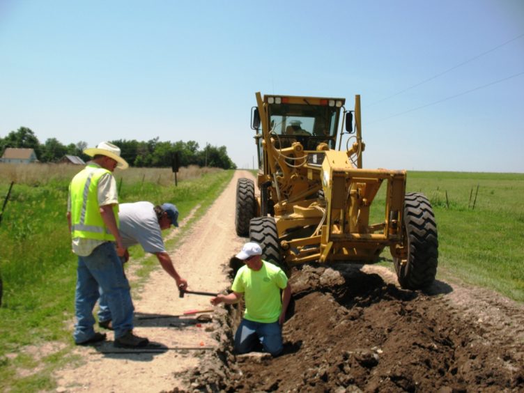 road? Between the wheel paths of a gravel road? You get the point. Eastern & Central Kansas have many rural roads that were not opened on the section line on purpose, let alone the ones that were not built on the section line in the first place. Many other roads have been pushed away from hedge rows through road maintenance or realigned due to a culvert or bridge. As a general rule, most Federal & State Highways are not centered on the section lines. And section lines do not magically drift to the “correct” position (middle of the road) over a period of years, nor do the roads mysteriously move themselves to the invisible Section lines! In the photo, the cornerstone is about 5 feet south of where most would call the “middle of the road”. “That there cornerstone ain’t too far off!” 😉
“Legal Description? I have that right here on my tax statement.”
Well, actually you don’t. That abbreviated writing is NOT a boundary description. It was written for the convenience of the County Appraiser as a location and is not copied from your deed ON PURPOSE. It is not, and never was, intended to be a boundary description. Most tax statements say this, usually in fine print. It may, however, help us find your actual recorded description. If you have title insurance, then we would like to see Schedule A & B of the Commitment for Title.
“That old fence has to be the line between me and my neighbor, it’s been there forever!”
This statement refers to the legal doctrine of adverse possession. Click here for a basic definition of adverse possession. Time is only one element of adverse possession (there are four or five more). The key here is that you are claiming what is, on paper at least, owned by another (that’s why it’s called adverse possession). This can only be true if the fence is admittedly incorrect! Granted, fences are often good evidence of where a line was originally marked or assumed to be. But be aware: no fence or testimony can change the true location of a section or quarter section line. They are fixed by law. You may claim to own by adverse possession land in another section or quarter, but adverse possession can never, ever change a section or quarter section line (Swarz v. Ramala, 63 Kan. 633). Also, only the courts, through a quiet title action, can make the determination of adverse possession, so don’t tell me I have to use that old fence only because its been there a long time. We just might tell you that we left our black robes and gavel back at the office! 😉
“My place must have been surveyed, it was bought and sold several times before I got it.”
Unfortunately for the new buyer, this statement is most likely false. Kansas was (and somewhat remains) a “buyer beware” State. Too often neighbors, realtors or the former owners will tell the buyers where they think the boundary lines are without any real knowledge other than “this is what I was told when I bought it” or “this is where the appraiser’s map shows it.” Remember that guesses by the seller or realtor are free to them, while surveys are not! Generally speaking, the more the property is worth, the greater the chance that it has been recently surveyed. Also, a product used for Title Insurance purposes only, the Mortgagee Title Inspection (MTI), has added to the confusion over the years. See our Work Order for an explanation of what the MTI does not do for boundary lines. As a potential buyer, you should insist that your new property have a boundary survey done, if nothing else for your own piece of mind. We regularly see stunned and dismayed land owners that now regret not having had their place surveyed at the time of purchase. We hear this far too often: “But that’s not where they told me the line was!”.
“With GPS, can’t you just put some coordinates into your satellite machine and come out and show me my land? Shouldn’t take but a minute!”
Our sophisticated GPS units and a pocket tape have a lot in common. They are both tools you can use to measure a distance. If none of the boundary corners are given in highly accurate Latitude and Longitude or State Plane Coordinates, which is extremely unlikely, then no amount of technology will pin point a location in of itself. Besides, and this is the most important point, it’s the application of historical surveys and legal principles to your boundary description that determines the locations of boundary lines, not the tools. A library full of law books does not make you a fine attorney!
“I need a survey. How much will it cost?”
Land surveying is a professional service and most professional fees are time based. How much time is needed to do a survey is NOT necessarily dependent on the size of the tract or lot. Travel time is another consideration. As boundary descriptions are unique, so are most boundary situations and so is the amount of time needed to survey a particular tract. Facts discovered through record search is a key factor. Expect a surveyor to ask a lot of questions about what, where and sometimes why. Don’t be surprised if you can’t get an answer immediately. It would be like calling up an attorney and saying “I want to sue my neighbor, how much will it cost?” and then expecting an immediate quote over the phone.
“I need to find an engineer to locate my boundary lines.”
No, you need a Professional Surveyor. Only Professional Surveyors are authorized to do any surveying of “real property for the establishment of land boundaries, rights-of-way, easements and the dependent or independent surveys of the public land survey system.” It’s state law. KSA 74-7003 (p) (2). When it comes to land boundaries, the land owner is also prohibited from surveying their own land as well (An obvious conflict of interest!).
“I pay taxes to the middle of the road.”
Well, no you don’t. Even if the road was opened up “on the line” (see the first myth), the county appraiser, by law, gives you ample tax credit for that part used by the public as an easement. And this applies to State and Federal highways too. While you may own to the “middle of road”, you are not paying taxes on the land area used as an easement. This is why the Appraiser’s taxable area is invariably less than the actual surveyed area. (Usually about two acres per half mile of road frontage in rural areas) This myth is a personal favorite of ours because it is so common and not even close to true!
“Your survey is wrong. See, look here at the county appraiser’s map.”
The GIS systems statewide are excellent tools put together by highly trained and professional mappers. But due to a lack of actual photo identifiable ground control, these dedicated professionals are not only forced to make assumptions as to location of section corners, but they also have to abide by the State’s Property Valuation Division rules on property mapping. All GIS maps have a note that reads something like “Not survey accurate”. Be assured that they really, really mean it.
“I bought 40 acres but some how it’s now only 39 acres!”
Most people will see their “taxable” acres on their tax statement and assume that this is their “total” acres. The County is only interested in taxable acres. Credit is usually given for county and state road easements, so your actual acreage is generally greater than the taxable acres. See above. Can you guess which one a buyer wants to use and which one the seller wants to use? Correct! Also if your description is an aliquot part (fraction) like the E½SW¼ then your deed will most likely say
“containing 80 acres, more or less.“